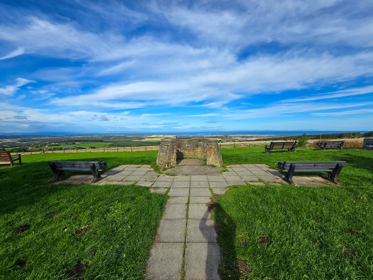
Some of the best views in Moray don’t need a long hike to reach them. Califer Hill Viewpoint sits on the hills about four miles east of Forres, and from its little grassy summit garden you look straight down over the rich farmland of the Laich o’ Moray to Findhorn Bay, the Moray Firth and, on a clear day, the hills of Sutherland and Caithness far across the water.
Janette and I visited at the very end of September 2026 on one of those crisp, bright autumn days that make Moray look its absolute best. The sky was a deep blue, the rowans were heavy with berries, and the visibility was so good that we could pick out landmarks more than 30 miles away. Here’s everything you need to know about this peaceful spot, its surprising history, and what you can see from the top.
The History of Califer Hill
The Town’s Hill
Califer Hill rises to 209 metres (685 feet), with the viewpoint itself sitting at around 185 metres just below the summit. For centuries this was not private estate land but the property of the town of Forres. When the Ordnance Survey mapped Moray between 1868 and 1871, its surveyors described Califer as a small district of farmland, heather and scattered trees, about a mile long, squeezed between the parishes of Rafford and Kinloss and belonging entirely to the town. The farms of Califer, Upper Califer and Easter Califer were all let out by the burgh to local tenants.
One curious survivor of those days is the Califer Stone, a large boulder near Upper Califer. After every election of a new provost, the town councillors of Forres would ride the boundaries of the parish (a tradition known as riding the marches), and this stone was their meeting point at the end of the ride. By the 1860s the custom had died out, and the surveyors noted with some regret that a tenant farmer had broken off pieces of the stone to use as building material.
Hugh Couper’s Viewfinder
The centrepiece of the viewpoint is a circular stone plinth topped with a large steel viewfinder plate. Engraved lines radiate out from the centre, each one pointing to a town, hill, headland or landmark with its distance in miles. It’s a wonderful thing to stand over, matching the names to what you can actually see.
The plate tells its own story. It was designed by Hugh W. Couper, a teacher at Forres Academy, shortly before his untimely death in 1964, and it stands as a memorial to his efforts to help others enjoy the hills he loved. More than 60 years later, it’s still doing exactly that.

A Garden of Remembrance
Over the years, Califer became a favourite place for local families to remember loved ones. Many memorial trees were planted on the grass around the viewfinder, often with small stones or plaques beneath them, and today the viewpoint feels almost like a quiet garden. The birches, rowans and cherries were turning gold and red when we visited, and they make the place feel very different from a typical bare hilltop viewpoint.
The popularity of the site eventually became a problem. Moray Council stopped new memorial plantings in 2014 to prevent the viewpoint becoming over-saturated, and after tributes continued to appear, it carried out an audit of every existing tree and plaque. Those recorded in the audit remain, but the council confirmed that any new additions would be removed from March 2022 to protect the views and the appearance of the hill.
Blervie Castle
Look down the hill to the south-west and you’ll spot a tall, lonely stone tower standing among the fields and farmhouses. This is Blervie Castle, one of the most striking landmarks visible from Califer. There was a royal castle here as early as 1263, when the Exchequer Rolls record repairs being made to it in case King Haakon IV of Norway’s invasion reached the north-east (in the end, it landed on the west coast instead).
The tower you see today was built around 1600 by the Dunbar family as a Z-plan tower house, and an armorial panel dated 1598 once adorned it. In about 1776 most of the castle was taken down to provide stone for the new house of Blervie nearby, leaving only one five-storey corner tower and a fragment of the main block. In 2006, after a photographic survey, the unstable roof and corner turrets were removed. It was once said that parts of seven counties could be seen from the top of the tower, which tells you a lot about why both Blervie and Califer were chosen as vantage points.

The XV Squadron Memorial
Near the edge of the viewpoint, looking out over the firth, stands a polished granite memorial with a large white “XV” at its base. It remembers Squadron Leader Samuel Bailey, Flight Lieutenant Adam Sanders and Flight Lieutenant Hywel Poole of XV Squadron, who lost their lives on 3 July 2012 when two Tornado GR4 jets from RAF Lossiemouth collided over the Moray Firth. One crew member survived. With poppy wreaths laid at its base and the very waters where the accident happened stretching out behind it, it’s a moving place to pause for a moment.

Our Visit to Califer Hill Viewpoint
Getting There and Parking
We approached from the A96, heading east from Forres towards Elgin. About two miles out of town, there’s a brown sign for Califer Viewpoint and Brodieshill. From there, a narrow single-track road winds uphill for about two miles past farms and woodland. Take your time on this road, as you may meet tractors or other cars coming down, and use the passing places.
The viewpoint car park appears on the right just before the road starts to drop down the other side of the hill. It’s a large, free gravel car park, ringed with boulders and trees, and there was plenty of space when we arrived. There’s a green wheelie bin at the edge of the car park for rubbish, but there are no toilets, so plan ahead. The nearest facilities are back in Forres.


From the car park, a short paved slab path leads through the trees to the viewing area. It only takes a minute to walk, and along the way you pass a couple of picnic benches set on paving, which would make a lovely spot for lunch on a calm day.


The Viewing Area
As you walk along the path, the trees open up and the view starts to appear ahead of you, framed by the branches. It’s a lovely reveal. The path leads straight to the stone plinth that holds the viewfinder, with benches arranged around it on a paved semicircle, all facing out over the firth.


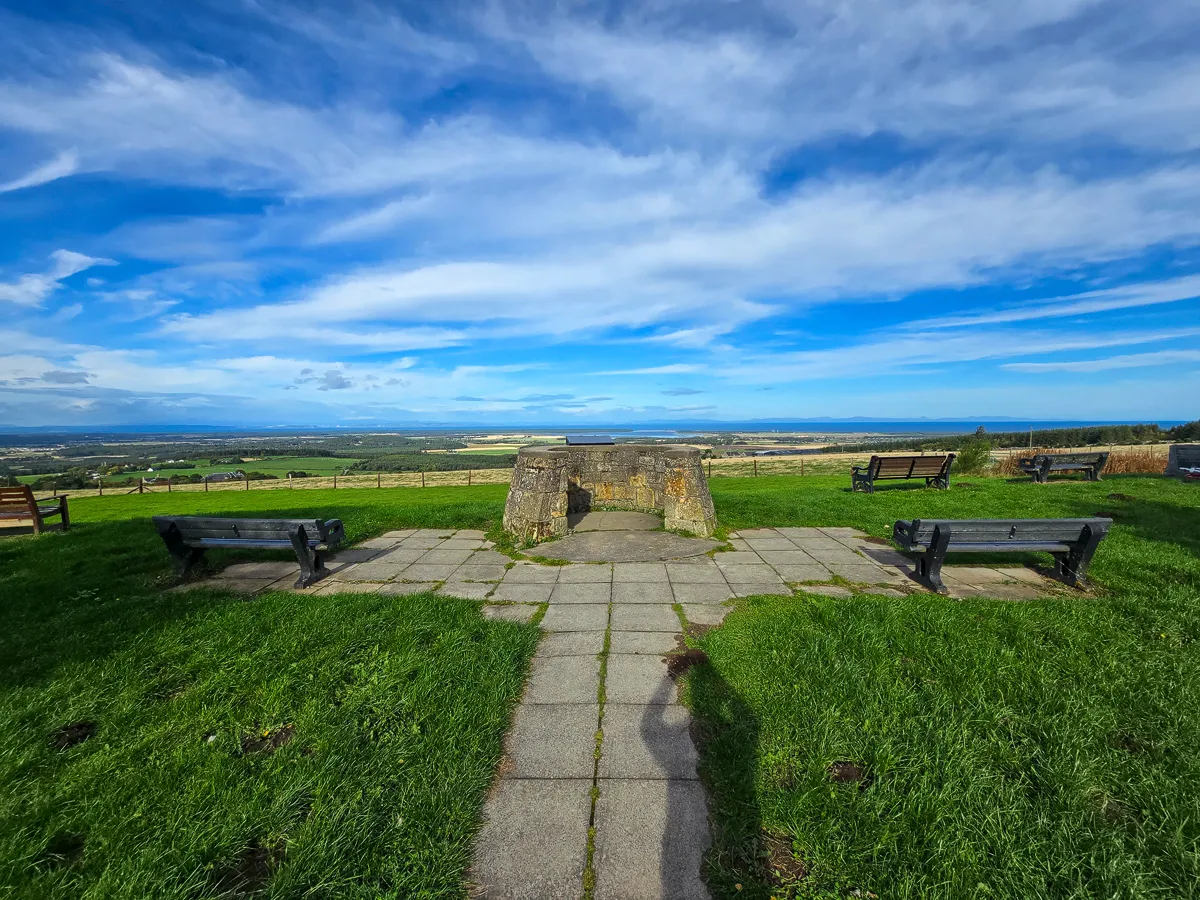
We spent a good while standing over the viewfinder, turning back and forth between the plate and the landscape. It lists everything from nearby farms and villages to distant mountains, with distances in miles, and it really helps you make sense of the enormous view.

Benches are scattered around the grass, some facing the firth and others looking south over the rolling Moray countryside towards the hills. Many of them carry small dedication plaques. It’s a very peaceful place, and apart from a couple of other visitors and the wind in the trees, we had it almost to ourselves.

What We Could See
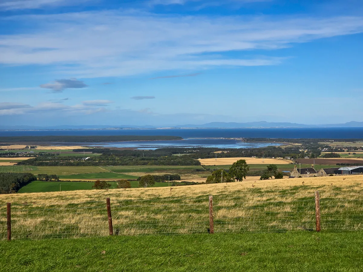
We were incredibly lucky with the weather. The air was so clear that we could see right across the Moray Firth to the hills of Caithness, including the unmistakable peak of Morven, the highest hill in Caithness at 706 metres. Its distinctive cone shape is visible from much of the Moray coast on clear days.
Directly below us lay Findhorn Bay, a large tidal basin and local nature reserve, with the village of Findhorn strung out along the narrow spit of land where the bay meets the open firth. With the tide partly out, the sandbanks and channels shimmered in the sunshine.

Looking further west, we spotted Brodie Castle peeking out of the woodland, with the dark expanse of Culbin Forest beyond it. On the far side of the firth, the two great headlands of the Sutors of Cromarty guard the entrance to the Cromarty Firth, with the oil rigs at Nigg sitting between them. That’s also where the little Cromarty Ferry crosses between Cromarty and Nigg, which we’ve taken ourselves on an earlier trip.

Zooming in to the north, beyond Kinloss and its airfield, we could just make out a tiny white tower on the far shore. This was Tarbat Ness Lighthouse, at the tip of the Tarbat peninsula in Easter Ross. It’s the tallest lighthouse on the Scottish mainland, but even so, from here it was just a speck on the horizon.

Of course, we couldn’t leave without a selfie to prove we’d been there.

A Place of Remembrance
Wandering around the grass, we were struck by how many memorials there are. Almost every tree has a small stone, slate or plaque beneath it, some professionally engraved and others lovingly handwritten, often decorated with pebbles, shells and flowers. They are clearly still visited and cared for, and we made sure to walk carefully around them.


A sign by the path explains that no new trees or memorials are permitted, and that new additions will be removed. Having seen how many there already are, it’s easy to understand why the council made that decision, while still respecting what the place means to so many local families.


After soaking up the view, we headed back down the hill and made our way to the nearby Loch of Blairs, which made a lovely, tranquil end to the afternoon.
Videos from Califer Hill Viewpoint
FAQs About Califer Hill Viewpoint
Is Califer Hill Viewpoint free to visit?
Yes. There is no charge to visit Califer Hill Viewpoint and the car park is free. The site is open at all times, although it is best enjoyed in daylight and on a clear day.
Where do you park at Califer Hill Viewpoint?
There is a good-sized, free gravel car park right beside the viewpoint. From the A96 east of Forres, follow the brown sign for Califer Viewpoint and Brodieshill, then climb the single-track road for about two miles. The car park is on the right near the top of the hill.
Are there toilets at Califer Hill Viewpoint?
No. There are no toilets or refreshments at the viewpoint. The nearest public toilets, cafes and shops are in Forres, about four miles away. There is a green wheelie bin in the car park for rubbish.
Is Califer Hill Viewpoint accessible for wheelchairs and pushchairs?
The car park is gravel and a paved slab path leads from it to the viewfinder and the main seating area, so most visitors should be able to reach the viewpoint. Some slabs are a little uneven, and the benches away from the path are on grass.
Can I bring my dog to Califer Hill Viewpoint?
Yes, dogs are welcome. The viewpoint is surrounded by farmland, so please keep dogs on a lead near livestock, clean up after them, and remember that the grassy area is a place of remembrance for many local families.
What can you see from Califer Hill Viewpoint?
On a clear day you can see across the Laich o’ Moray to Findhorn Bay, Findhorn village, Kinloss and Forres, then over the Moray Firth to the Black Isle, the Sutors of Cromarty, Tarbat Ness Lighthouse and the hills of Sutherland and Caithness. Closer to hand, you can pick out Blervie Castle and Brodie Castle.
Can I plant a memorial tree at Califer Hill Viewpoint?
No. Moray Council stopped new memorial plantings in 2014 because the viewpoint was becoming overcrowded with tributes. Existing trees and plaques recorded in the council’s audit remain, but any new trees, plaques or memorials are removed.
Key Information
- Location: Califer Hill, near Forres, Moray, IV36 2RN (about four miles east of Forres)
- Grid Reference: NJ 0845 5702
- What3words: tastier.coverings.downcast
- Managed by: Moray Council
- Entry: Free
- Parking: Free gravel car park beside the viewpoint, reached by a single-track road from the A96
- Facilities: Viewfinder, benches, picnic tables and a wheelie bin. No toilets or refreshments
- Accessibility: Paved slab path from the car park to the viewfinder. Some slabs are uneven and the outer benches are on grass
- Dogs: Welcome. Keep on a lead near livestock
What Else is Nearby?
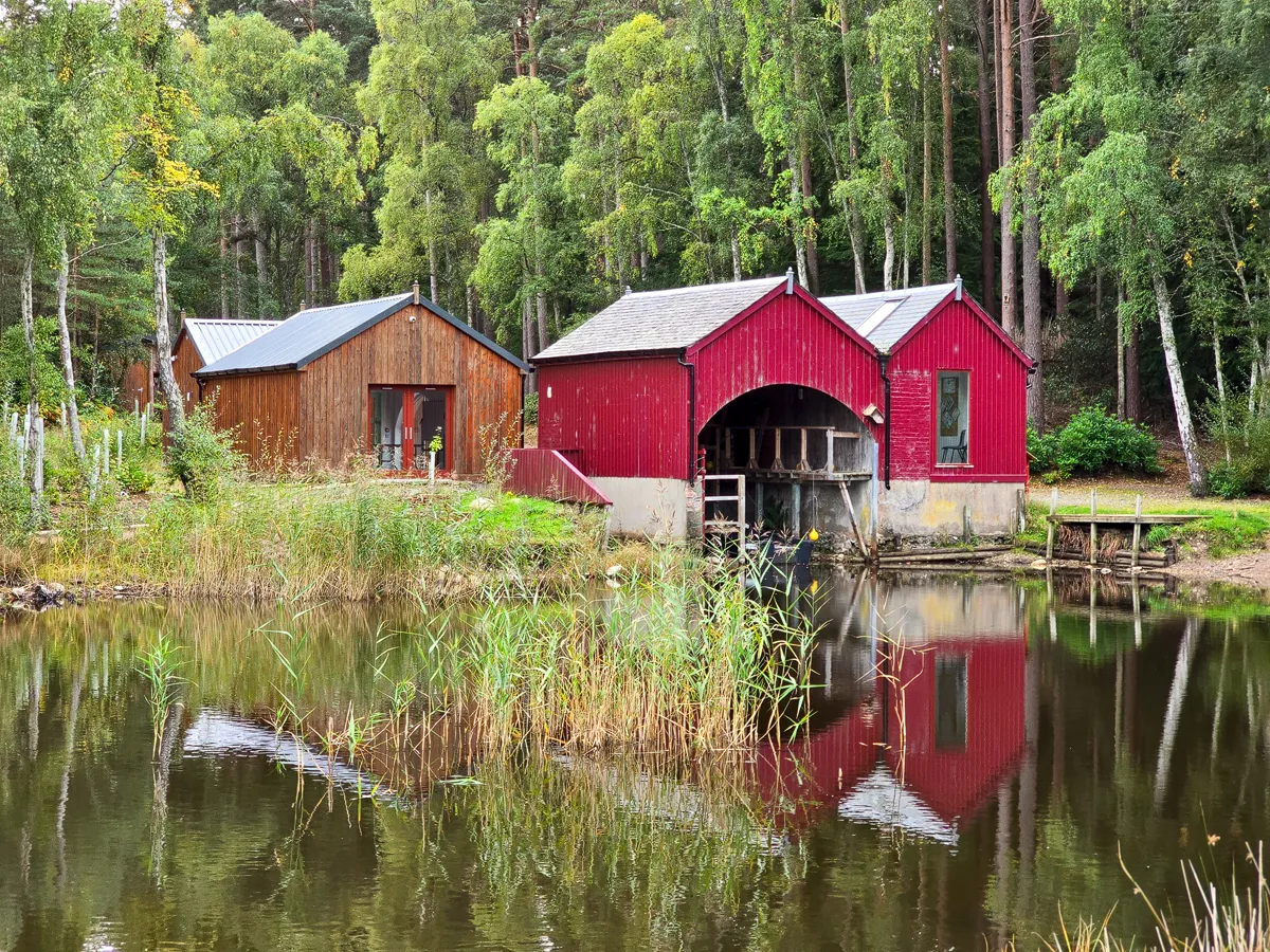
- Loch of Blairs – a peaceful loch on the Altyre Estate south of Forres, with woodland paths, bird hides and a restored boathouse. We headed here straight after Califer.
- Brodie Castle – the 16th-century ancestral home of the Brodie family, now cared for by the National Trust for Scotland, with fine interiors, gardens and the Playful Garden.
- Findhorn Bay and Findhorn village – the tidal bay you see from Califer is a local nature reserve, great for birdwatching, and Findhorn itself has a lovely beach and heritage centre.
- Sueno’s Stone, Forres – an enormous carved Pictish cross-slab on the edge of Forres, said to be the tallest carved stone in Scotland.
- Dallas Dhu Distillery – a preserved Victorian distillery near Forres, kept as a museum of how whisky used to be made, and passed by the Califer and Rafford circular walk.
Conclusion
Califer Hill Viewpoint is one of those places that locals have known about for generations but visitors often drive straight past on the A96. That’s a real shame, because for a two-mile detour up a quiet back road you get one of the finest panoramas in the north-east of Scotland, with almost no effort at all.
What makes Califer special for us, though, is more than the view. Between the town’s old hill farms, Hugh Couper’s viewfinder, the XV Squadron memorial and the trees planted by so many families, it’s a place that clearly means a great deal to the people of Forres. Pick a clear day, bring a flask and a picnic, take your time with the viewfinder, and treat the memorials with the respect they deserve. If you’re keen on walking, the 10-mile circular route from Forres via Califer, Rafford and the Dava Way is well worth considering too. We’ll certainly be back.

Leave a comment below