Living just outside Buckie, I have often looked across the bay to Lossiemouth and noticed a fairly large hill at the far side of Kingston. I learned that this hill is called Binn Hill (not to be confused with the Bin of Cullen or the Bin Hill near Huntly), and the area around it is named the Lein Nature Reserve.
Lein Nature Reserve is a very interesting area with a diverse landscape. It includes the mouth of the River Spey, many remnants of World War 2 fortifications, huge shingle beaches, forest tracks, a shooting range, and the Binn Hill Viewpoint. Wildlife and wild flowers are also abundant here, with a strong chance of seeing dolphins and ospreys between the Spey and Lossiemouth.
My family and I visited on a cool, windy day at the beginning of March.

Lein Car Park & Beach
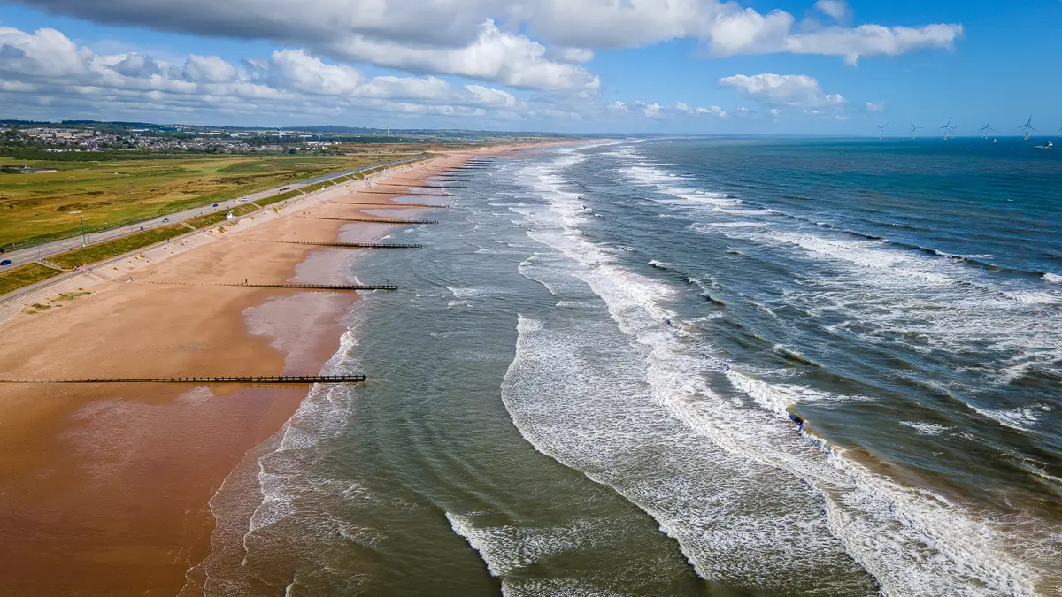
We made our way to Lein Car Park via Mosstodloch, Garmouth, and Kingston. We were the only ones at the car park, which had ample parking space. From the car park, it was a short walk to the enormous shingle beach that stretches far around the bay and eventually joins the beautiful Lossiemouth East Beach. The sound of the waves hitting the shingle was quite something.


World War 2 Defences
This stretch of coastline has an incredible amount of World War 2 defence buildings, including pill boxes and tank traps that line the entire beach! Some of the pill boxes have slipped down into the sea and still seem to be holding up well to the never-ending onslaught of waves.


You can walk down by the defences or via a more solid track directly next to them, the Corbiewells Estate Walk. We eventually reached this vertical structure and then turned left from the beach onto a forest track.


We passed large areas filled with rounded beach stones. I'm not sure what the purpose of these areas is, considering there is a warning sign on the beach about erosion. These masses of stones would go a long way towards shoring it up!
Following the path, we arrived at a gate and then a muddy path leading into the forest. The diversity of locations in Moray is unreal; this forest felt very different from the Culbin Forest near Forres, despite both being located on the coast.


The Binn Hill
After a short time, we arrived at an old Nissen hut still in great condition. The hut and a green sign mark the beginning of the ascent of Binn Hill. This was the only signpost on the route, which wasn't ideal, but we found our way to the summit.


The forest path is well trodden, with some steep sections, and then opens up into an open valley. We kept on this track until we reached a fork in the road. We chose the right-hand side and continued on.


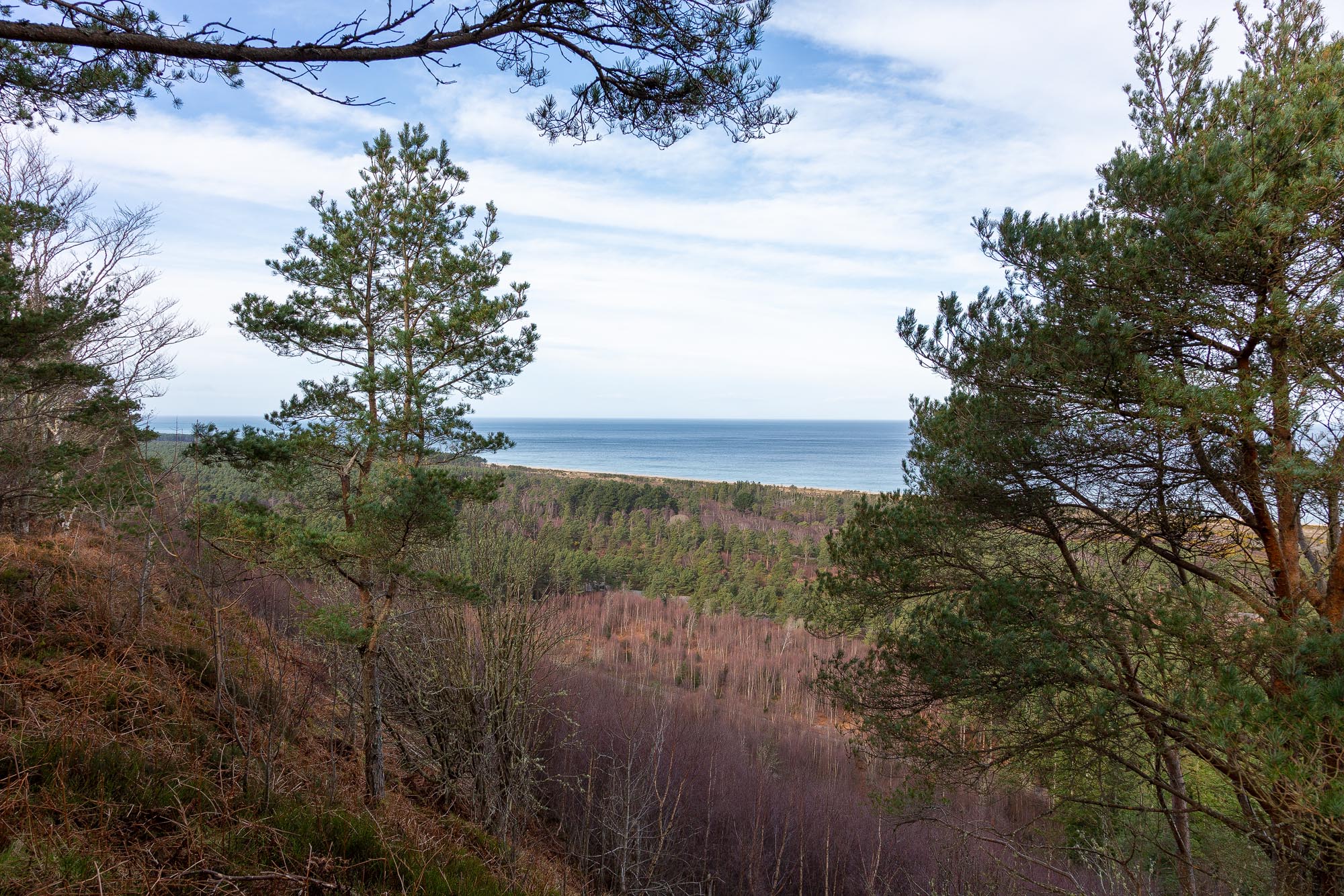
This next section was my favourite part of the entire walk. The hill affords excellent views of the forest below and the Moray Firth. There are amazing views looking back towards the Bin of Cullen and my hometown of Buckie.


The summit is marked with a single bench giving a panoramic view from Lossiemouth to Buckie, taking in many miles of forested coastline - this is easily my second favorite view of the Moray Coast!


It's also possible to see across the Moray Firth and see the distinctive conical outline of Morven (a future expedition!).
We spent some time here taking in the views, then continued along the obvious path leading back down the hill. We connected with a long, straight forestry track, which took us back to the Nissen hut, where we first began our ascent.


Military Firing Range
This time, we took the route back to the beach via the shooting range, which was thankfully not being used. This was an interesting place with pits dug into the ground for people to stand in while they shoot rifles at targets at the end of the range. It's important to note that if you see red flags flying, the range should be avoided.

The path arcs around to the right and reconnects with the coastal path back to Lein Car Park.


FAQs on Binn Hill Viewpoint Walk
How to get to Lein Car Park?
The nearest main road is the A96, which connects Aberdeen and Inverness. The car park is near the small village of Kingston, which can be accessed from the A96 via Lhanbryde or Mosstodloch. Here is a Google Maps link from Elgin to the car park.
Where are the nearest public toilets?
The Threaplands Garden Centre (near Lhanbryde) and Christie's Garden Centre (Fochabers) have toilets. If you intend to walk onwards to Lossiemouth, there are toilets on Seatown Road.
Can I walk from Lossiemouth to Binn Hill Viewpoint?
Yes, it's possible to walk from Lossiemouith East Beach through Lossie Forest and reach Binn Hill Viewpoint.
How difficult is the Binn Hill Viewpoint walk?
The walk is fairly easy; the beach sections are completely flat. The hill sections are steep to begin with but then fairly gradual as you continue to the top. After visiting the summit, the path back to the Nissen hut is quite rocky, so good footwear is a must!
Is the Binn Hill Viewpoint walk safe for kids and dogs?
Most sections are safe, but the areas near the viewpoint have some very steep drops, so keep dogs on a lead and the kids close while at the top.
Are there other areas of interest near Lein Nature Reserve?
You can take the Spey Viaduct to Spey Bay if you fancy continuing your walk. Spey Bay is the best place to spot wildlife, as the River Spey terminates into the North Sea. The WDC Wildlife Centre, which offers a cafe, exhibition, and toilets, can also be accessed here.
If you are an insatiable walker, you can also walk another few miles east to Portgordon to see the seals which bask on the rocks and beach at low tide.
If you intend to drive to the east side of Spey Bay, you will need to return to the A96, head to Fochabers and then take the A98. You cannot drive over the Spey Viaduct.
The walk at Loch Na Bo is also worth your consideration.
Key Information
-
Binn Hill Viewpoint / Lein Nature Reserve is found between Kingston and Lossiemouth on the Moray Firth Coast.
-
Lein Car Park just past Kingston is the best place to park.
-
The walk offers many sights, including remnants of World War 2, the shingle beach, the Spey Bay river mouth, a firing range, and stunning views.
-
The town of Buckie and the Bin of Cullen can be seen to the south east.
-
Our route was 5.34 miles long and took 2 hours and 11 minutes.
Conclusion
I can highly recommend the Binn Hill Viewpoint and Lein Nature Reserve Walk. The route is so varied with its exposed coastal section, World War 2 interest, then peaceful forest track, giving way to stunning panoramic views of the Moray Coast. What more could you ask for in a walk?

Leave a comment below