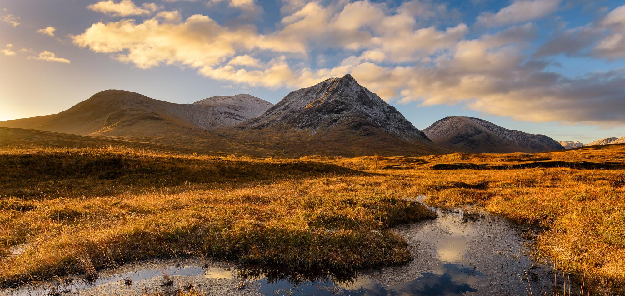
Scotland has some of the finest walking in Europe, and I don’t say that lightly. From short family-friendly strolls through ancient Caledonian pine forest to multi-day expeditions across wild moorland and mountain passes, this country packs an extraordinary range of landscapes into a relatively compact area. You can walk along dramatic sea cliffs in the morning, through a whisky-producing glen in the afternoon, and summit a mountain with views stretching to the Atlantic before dinner.
What makes Scotland particularly special for walkers is the Scottish Outdoor Access Code. Unlike much of England and Wales, Scotland grants everyone the right of responsible access to most land and inland water. That means you can walk almost anywhere – across open hillside, along riverbanks, through forests – provided you do so responsibly. It’s a freedom that transforms the walking experience, and it’s something I’ve never taken for granted, even after a lifetime living here.
Then there’s Munro bagging – the pursuit of climbing all 282 Scottish mountains over 3,000 feet (914 metres). Named after Sir Hugh Munro, who first catalogued them in 1891, it’s become something of a national obsession. Some people spend decades ticking them off. But you don’t need to be a Munro bagger to enjoy walking in Scotland. Some of the best walks in the country are gentle lochside circuits, coastal paths, and forest trails that anyone in reasonable health can enjoy.
Living in Moray in the northeast of Scotland, Janette and I are fortunate to have world-class walking on our doorstep – from the Moray Coast Trail to the Cairngorms. But we’ve walked all over Scotland over the years, and this guide draws on those experiences to bring you the best walks and hikes the country has to offer, from short day walks to epic long-distance trails.

Contents
- Best Day Walks in Scotland
- Arthur’s Seat, Edinburgh
- Old Man of Storr, Isle of Skye
- The Quiraing, Isle of Skye
- Fairy Pools, Isle of Skye
- Ben Nevis, Fort William
- Steall Falls, Glen Nevis
- Lost Valley, Glencoe
- Buachaille Etive Beag, Glencoe
- Ben A’an, Trossachs
- Ben Lomond, Loch Lomond
- Stac Pollaidh, Assynt
- Goatfell, Isle of Arran
- Grey Mare’s Tail, Moffat
- Glen Affric
- Quieter Walks Worth Knowing About
- Best Long-Distance Trails in Scotland
- Essential Walking Advice for Scotland
- Frequently Asked Questions
Best Day Walks in Scotland
These are the walks that appear on every Scottish walking list for good reason. I’ve included a mix of difficulty levels and regions – from a gentle city walk to a full-day mountain ascent – so there’s something here regardless of your fitness or experience. For each walk, I’ve noted the approximate distance, time, and difficulty to help you plan.
Arthur’s Seat, Edinburgh
Distance: 2.5 miles (4 km) circular | Time: 1.5–2 hours | Difficulty: Easy to moderate
If you only have time for one walk in Edinburgh, make it Arthur’s Seat. This 251-metre extinct volcano sits right in the heart of the city within Holyrood Park, and climbing to its summit gives you one of the finest urban panoramas in Britain. Edinburgh Castle, the Firth of Forth, the Pentland Hills, and on clear days the Highlands far to the north – it’s all laid out before you.
The hill was formed around 350 million years ago by volcanic activity, the same geological forces that created Castle Rock and Calton Hill. There are several routes to the summit: the green route is the most gradual and family-friendly, while the red route via Salisbury Crags is steeper but offers dramatic cliff-edge views. Either way, you’ll be up and down within a couple of hours.

What I love about Arthur’s Seat is how quickly you transition from city streets to what feels like genuine hillwalking. Within ten minutes of leaving the Royal Mile, you’re on open grassland with skylarks overhead and the noise of traffic fading behind you. It’s a proper hill walk in miniature – and on a windy day, the summit will remind you that you’re very much in Scotland.
Old Man of Storr, Isle of Skye
Distance: 2.5 miles (4 km) return | Time: 1.5–2.5 hours | Difficulty: Moderate
If there’s one image that defines the Isle of Skye, it’s the Old Man of Storr. This 50-metre basalt pinnacle stands among a surreal landscape of rock towers and grassy slopes, the remnants of an ancient landslip on the Trotternish Ridge. The walk from the car park is relatively short but steep – you’ll climb around 200 metres on a well-maintained (if sometimes boggy) path before the pinnacles come into view.

A word of warning: this is Skye’s most visited walking destination, and in summer the car park fills up early. Aim to arrive before 9am or after 5pm if you want to avoid the worst of the crowds. Early morning visits have the added bonus of softer light for photography, and on a clear day you can see across to the Scottish mainland and the Outer Hebrides.
The Quiraing, Isle of Skye
Distance: 4.5 miles (7 km) circular | Time: 2–3 hours | Difficulty: Moderate
If the Storr impresses, the Quiraing astonishes. Sitting at the northern end of the Trotternish Ridge, this massive landslip – one of the largest in Britain – has created a landscape of pinnacles, cliffs, hidden plateaux, and grassy slopes that looks like something from another world entirely. It’s been used as a filming location for everything from Prometheus to Stardust, and standing among the formations you can see why.

The circular walk takes you through the heart of the landslip and along the top of the Trotternish Ridge, with views extending as far as the Outer Hebrides on clear days. The path has some boggy sections and a couple of spots where you’ll need to pick your way carefully over loose ground, but it’s manageable for anyone with a reasonable level of fitness and proper footwear. The road up to the car park is steep and winding – not ideal for large motorhomes. If you’re into photography, sunrise here is extraordinary – the east-facing cliffs catch the golden light as the mist clears over the sea.
Fairy Pools, Glen Brittle, Isle of Skye
Distance: 1.5 miles (2.4 km) return | Time: 1–1.5 hours | Difficulty: Easy
The Fairy Pools are a series of crystal-clear pools and waterfalls fed by springs from the Black Cuillin mountains. The water is remarkably transparent – you can see every pebble on the bottom – and the backdrop of the Cuillins rising steeply behind adds serious drama. The walk from the car park follows the Allt Coir’ a’ Mhadaidh burn upstream, and on a sunny day the turquoise water against the dark Cuillin gabbro rock is genuinely breathtaking.

This is one of the easiest walks on Skye and suitable for families, though the path can be uneven and slippery near the pools. Wild swimming is popular here, though be warned – the water is fed by mountain springs and is absolutely freezing, even in August. Like the Storr, the Fairy Pools can get extremely busy in summer. The car park charges a fee and fills up quickly, so early mornings are your best bet.
Ben Nevis, Fort William
Distance: 10 miles (16 km) return via Mountain Track | Time: 7–9 hours | Difficulty: Challenging
At 1,345 metres, Ben Nevis is the highest mountain in the British Isles, and climbing it is on many walkers’ bucket lists. The standard route – the Mountain Track (sometimes called the Pony Track) – starts from the Glen Nevis Visitor Centre and is the most popular approach. It’s not technically difficult, but it is a long, demanding day. The path climbs relentlessly, and the final section crosses a boulder field that can be disorienting in poor visibility.

The summit is famously often shrouded in cloud – it has clear skies on average only about 14 days per year – so don’t be surprised if your reward for seven hours of climbing is a view of grey mist and the remains of the old summit observatory. But when the clouds do part, the views are immense. Take proper equipment, check the forecast, and don’t underestimate this mountain. People get into serious difficulty on Ben Nevis every year. For experienced hillwalkers wanting something more adventurous, the Càrn Mòr Dearg arête offers a thrilling alternative route via a spectacular scrambling ridge.
Steall Falls, Glen Nevis
Distance: 3.5 miles (5.5 km) return | Time: 2–3 hours | Difficulty: Moderate
If you want the drama of Glen Nevis without the full Ben Nevis commitment, the walk to Steall Falls is perfect. Starting from the car park at the end of the Glen Nevis road, the path threads through the spectacular Nevis Gorge – a narrow, wooded ravine with the Water of Nevis thundering below. After about a mile, the gorge opens out into a broad, flat meadow, and there in front of you is Steall Falls, a 120-metre white ribbon of water plunging down the mountainside.

The gorge section has some rocky, uneven ground and can be slippery when wet, so decent footwear is important. Harry Potter fans might recognise the meadow from the Triwizard Tournament scenes in the films. A wire rope bridge crosses the river to the base of the falls, though it’s not for the faint-hearted and is entirely optional.
Lost Valley (Coire Gabhail), Glencoe
Distance: 3 miles (5 km) return | Time: 2.5–3.5 hours | Difficulty: Moderate to challenging
The Lost Valley is one of the most atmospheric walks in Scotland. Hidden between two of the Three Sisters of Glencoe, this high valley was historically used by the MacDonalds of Glencoe to hide stolen cattle – it’s completely invisible from the road below, which is part of its appeal. The walk starts from a layby on the A82 and involves a steep descent to the River Coe, a river crossing (stepping stones, which can be tricky after heavy rain), and then a sustained climb through boulders and birch woodland into the valley itself.
When you emerge into the flat floor of the Lost Valley, surrounded by towering mountain walls on three sides, the sense of isolation is remarkable. It’s hard to believe the busy A82 is just a mile away. This walk is popular, and rightly so, but it does require a degree of scrambling ability and confidence on rough terrain. The descent back down can be harder on the knees than the climb up.
Buachaille Etive Beag, Glencoe
Distance: 5 miles (8 km) return | Time: 4–6 hours | Difficulty: Challenging
While its bigger neighbour Buachaille Etive Mòr gets most of the attention (and the famous photographs), Buachaille Etive Beag is the more accessible of the two Glencoe Buachailles and arguably gives better views. The standard route ascends from the Lairig Eilde path between the two mountains, climbing steeply through grass and rock to the summit ridge. Once on top, you’re rewarded with a panorama that takes in Glencoe, Rannoch Moor, Ben Nevis, and the Mamores.

This is a proper mountain walk requiring boots, waterproofs, and confidence on steep ground. The descent can be slippery in wet conditions. But the effort is well worth it – Glencoe from above is something you won’t forget in a hurry. If you’re visiting Glencoe and looking for somewhere to stay, see our Glencoe and Loch Leven accommodation guide.
Ben A’an, Trossachs
Distance: 2.5 miles (4 km) return | Time: 1.5–3 hours | Difficulty: Moderate (steep in sections)
Ben A’an is the perfect introduction to Scottish hillwalking. At just 461 metres, it’s a fraction of the height of a Munro, but the views from the summit over Loch Katrine and the Trossachs are out of all proportion to the effort required. The walk is short and steep – it packs a good workout into a small package – and the rocky summit has that satisfying “proper mountain” feel despite the modest altitude.

The Trossachs are easily accessible from both Glasgow and Edinburgh (about an hour’s drive from either), making Ben A’an a realistic day trip from either city. The car park at the base fills up quickly on weekends, so arriving early is recommended. If you’re driving from Edinburgh or Glasgow, the nearby village of Callander makes a great stop for lunch – it’s well known for its bakeries and cafes, and the car park near the Trossachs Woollen Mill is a popular spot for seeing Highland cows.
Ben Lomond, Loch Lomond
Distance: 7.5 miles (12 km) return | Time: 5–7 hours | Difficulty: Challenging
Ben Lomond is Scotland’s most southerly Munro and one of the most climbed mountains in the country, thanks to its proximity to Glasgow (about an hour’s drive) and the spectacular views over Loch Lomond and the Trossachs National Park. At 974 metres, it’s a serious hill, but the well-maintained Ptarmigan Path makes the ascent manageable for most fit walkers.

There are two main routes: the Ptarmigan Path (the more popular, gradual approach from the south-east) and the steeper Tourist Route from Rowardennan. On a clear day, the summit views take in Loch Lomond in its entirety, the Arrochar Alps, and on exceptional days, as far as Northern Ireland. The car park at Rowardennan fills up very quickly in summer – arriving before 9am is almost essential at weekends. Ben Lomond is often cited as a good first Munro, and it’s easy to see why – challenging enough to feel like a real achievement, accessible enough to be realistic for most walkers.
Stac Pollaidh, Assynt
Distance: 2.5 miles (4 km) circular | Time: 2–4 hours | Difficulty: Moderate (scramble to summit)
Stac Pollaidh is the kind of mountain that makes you wonder whether you’ve accidentally teleported to Patagonia. Rising abruptly from the surrounding moorland in Assynt on Scotland’s northwest coast, its jagged sandstone ridge looks genuinely wild. The circular walk around the base takes about two hours and gives you all the drama without any technical difficulty. If you want to reach the east summit, that’s straightforward; the true west summit requires confident scrambling on exposed terrain and is not for everyone.

On a clear day, the views from the ridge extend across the Summer Isles, the Sea of the Hebrides, and the isolated peaks of Suilven and Cul Mor. The area around Assynt is some of the most sparsely populated landscape in Europe, and the sense of vast, untamed wilderness is palpable. If you’re travelling the NC500, Stac Pollaidh makes an excellent half-day stop. Just be prepared for midges in summer – they can be relentless in the sheltered areas around the car park.
Goatfell, Isle of Arran
Distance: 8 miles (13 km) return | Time: 5–7 hours | Difficulty: Challenging
Arran is often called “Scotland in miniature” for the way it packs Highland mountains, Lowland farmland, sandy beaches, castles, and a whisky distillery into a single island. Goatfell at 874 metres is the highest point, and climbing it is the classic Arran experience. Most of the ascent follows a well-defined path through woodland and then open hillside, but the final push to the summit involves a steep scramble over granite boulders that will get your heart racing.

The views from the top are remarkable – on clear days you can see the Mull of Kintyre, Jura, the Ayrshire coast, and reportedly as far as Northern Ireland. Arran is reached by CalMac ferry from Ardrossan to Brodick (about 55 minutes), and the walk starts from Brodick Castle. I’d recommend taking a car on the ferry to shorten the approach, and leaving time to explore the rest of the island afterwards – the Machrie Moor standing stones and the distillery at Lagg are both worth a visit.
Grey Mare’s Tail, Moffat
Distance: 2.5 miles (4 km) return to Loch Skeen | Time: 1.5–2.5 hours | Difficulty: Moderate
At 60 metres, Grey Mare’s Tail is one of the tallest waterfalls in the UK, and the walk up to it – and beyond to the pristine Loch Skeen above – is one of the finest short walks in southern Scotland. Located in the Moffat Hills between Edinburgh and Dumfries, it’s an area that many visitors to Scotland overlook entirely, which is a shame because the scenery here is genuinely dramatic.

The path starts with a steady climb alongside the Tail Burn, giving you increasingly impressive views of the waterfall as you ascend. Take your time and enjoy the cascade – the gradient eases once you reach Loch Skeen, a remote, tranquil loch that feels a world away from the A708 below. If you want more of a challenge, you can extend the walk to the summit of White Coomb (821 metres) for panoramic views across the Borders. The National Trust for Scotland manages the site and there’s a car park at the base with an honesty box for donations.
Glen Affric
Distance: Various – 5 to 16 miles depending on route | Time: 2–7 hours | Difficulty: Easy to challenging
Glen Affric is frequently described as the most beautiful glen in Scotland, and having been there, I wouldn’t argue. Tucked away west of Inverness, the glen contains one of the largest remnants of ancient Caledonian pine forest in the country, wrapped around a chain of lochs with mountain ridges on either side. In autumn, when the birch and pine are at their most colourful and the first snow dusts the summits, it’s absolutely extraordinary.

The most popular walk is the circular route around Loch Affric (about 10 miles), which follows good forest tracks with relatively gentle gradients. For something shorter, the Dog Falls loop near the east end of the glen is about 3 miles and gives you a taste of the ancient woodland and the River Affric. More ambitious walkers can tackle one of the several Munros that flank the glen. Glen Affric is accessed from Cannich, about 30 miles west of Inverness – the single-track road into the glen is scenic but slow.
Quieter Walks Worth Knowing About
The walks above are the ones you’ll find on most Scottish walking lists, and they deserve their place there. But Scotland’s real depth of walking goes far beyond the famous names. Here are some walks that Janette and I return to again and again – the ones we recommend to friends and family, the ones that rarely appear in travel blogs written by people passing through Scotland for a week. These are local knowledge picks, and they’re every bit as good as the headline acts in their own way.
An Lochan Uaine (The Green Loch), Cairngorms
Distance: 4 miles (6.5 km) circular via Ryvoan Trail | Time: 1.5–2.5 hours | Difficulty: Easy
An Lochan Uaine sits in a bowl of scree and ancient Scots pine near Glenmore in the Cairngorms, and its water is the most extraordinary shade of turquoise green. The colour is caused by a combination of algae and the reflection of surrounding pine trees, though local legend says it was turned green by fairies washing their clothes in it. I prefer the fairy explanation. The walk from Glenmore along the Ryvoan Trail takes about 40 minutes each way on a good forest track through beautiful Caledonian pine forest. Combine it with a visit to Loch Morlich for a great day out.

Loch Morlich Circular, Cairngorms
Distance: 3.5 miles (5.5 km) | Time: 1.5–2.5 hours | Difficulty: Easy
The Loch Morlich circular walk is one of the finest family-friendly walks in the Highlands. The trail loops around the loch through ancient Caledonian pine forest, with the Cairngorm mountains forming a stunning backdrop. The paths are mostly well-surfaced gravel, and the pace is gentle enough to enjoy the wildlife – red squirrels, crested tits, and crossbills are all possible sightings. The golden sandy beach at Loch Morlich is an added bonus – it’s the highest beach in the UK. If you’re staying in the Aviemore area, this is an essential walk.

Loch An Eilein, Rothiemurchus
Distance: 3.5 miles (5.5 km) | Time: 1.5–2 hours | Difficulty: Easy
Loch An Eilein is arguably the most beautiful loch in the Cairngorms. A ruined 13th-century castle sits on a small island in the centre, surrounded by ancient Caledonian pine forest and ringed by mountains. The circular walk around the loch is flat, well-maintained, and suitable for all abilities. The castle was built as a safe house for the Bishop of Moray and later fortified by the notorious Wolf of Badenoch in the 1380s.

Craigellachie National Nature Reserve, Aviemore
Distance: 2.5 miles (4 km) | Time: 1–1.5 hours | Difficulty: Moderate
Craigellachie NNR sits right next to Aviemore and offers a short but rewarding climb through silver birch woodland to a summit cairn with extraordinary views over the town, the Cairngorm mountains, Loch Alvie, and Loch Insh. Janette and I walked it on a cold January morning and were genuinely stunned by the panorama at the top. Start from the Aviemore Youth Hostel car park. I can’t believe it took me so many years of visiting Aviemore to finally do this walk.

Uath Lochans, Kingussie
Distance: 2–4 miles (3–6.5 km) | Time: 1–2 hours | Difficulty: Easy to moderate
Uath Lochans is a beautiful collection of small lochans near Loch Insh, south of Aviemore. The shorter flat circuit around the nearest lochan is suitable for all abilities. The longer Farleitter Crag Trail climbs through forest to viewpoints with spectacular views over the Strathspey valley. Top tip: follow the red path clockwise for the best views quickest.

Duncansby Stacks, Caithness
Distance: 2 miles (3 km) return | Time: 45 minutes–1.5 hours | Difficulty: Easy
Most people driving the NC500 stop at John o’ Groats for the signpost photo and move on. Just two miles further lies Duncansby Head – the true most north-easterly point of the British mainland – and it’s infinitely more impressive. The short walk from the Stevenson lighthouse along the cliff edge leads to the Duncansby Stacks, towering pyramids of ancient Old Red Sandstone rising from the sea. Unfenced cliff edges, so keep children and dogs close. Puffins, razorbills, guillemots, and fulmars nest on the cliffs in summer.

Fairy Glen Falls, Rosemarkie
Distance: 1 mile (1.5 km) return | Time: 30–60 minutes | Difficulty: Easy
Tucked behind the village of Rosemarkie on the Black Isle, Fairy Glen Falls is a short, enchanting walk through a wooded gorge to two waterfalls. The lower falls cascade into a cool, shallow pool surrounded by moss-covered rocks and dappled light – it genuinely looks like a fairy grotto. A steep stairway leads to the upper falls, which are even more impressive. Perfect if you’re on the NC500 or heading towards Inverness.

Best Long-Distance Trails in Scotland
Scotland has 29 officially designated Great Trails, collectively covering over 1,900 miles. These are distinctively waymarked, largely off-road, and designed for multi-day walking. Here are the ones I’d recommend most highly.
West Highland Way
Distance: 96 miles | Duration: 6–8 days | Route: Milngavie to Fort William
Scotland’s most famous long-distance trail, and for good reason. The West Highland Way runs from the northern edge of Glasgow to the foot of Ben Nevis, passing through some of the country’s most iconic scenery: the shores of Loch Lomond, the atmospheric emptiness of Rannoch Moor, the dramatic pass of Glencoe, and the Devil’s Staircase with its views over to the Mamores. It attracts around 30,000 walkers per year, and accommodation along the route books up well in advance during summer.

The trail varies from gentle lochside walking to rough, exposed moorland, and the weather can change dramatically from one section to the next. Baggage transfer services are available if you don’t want to carry everything yourself. If you only have time for one section, the stretch from Kingshouse over the Devil’s Staircase to Kinlochleven is the most dramatic.
Speyside Way
Distance: 65 miles | Duration: 4–6 days | Route: Buckie to Aviemore (extended to Newtonmore)
The Speyside Way runs from the fishing town of Buckie on the Moray coast inland along the River Spey to Aviemore in the Cairngorms, with a recent extension to Newtonmore. It passes through the heart of Scotland’s whisky country – more than 50 distilleries operate in Speyside – making it the trail of choice for anyone who enjoys a dram at the end of a day’s walking. Living in Moray, sections of the Speyside Way are on my doorstep, and I can vouch for the quality of the walking and the scenery. The section between Craigellachie and Ballindalloch is particularly beautiful.
Great Glen Way
Distance: 79 miles | Duration: 4–6 days | Route: Fort William to Inverness
Following Scotland’s natural fault line from Fort William to Inverness, the Great Glen Way offers stunning views of the Caledonian Canal, Loch Lochy, Loch Oich, and the famous Loch Ness. This is a good introduction to long-distance walking, as most of the trail follows lower-level paths and tracks. The high-level option between Fort Augustus and Drumnadrochit rewards walkers with panoramic views but adds significant difficulty.
Moray Coast Trail
Distance: 50 miles | Duration: 3–5 days | Route: Findhorn to Cullen
This is one I can speak to personally, having walked sections many times. The Moray Coast Trail follows the coastline of the Moray Firth through a string of picturesque fishing villages – Findhorn, Burghead, Hopeman, Lossiemouth, Buckie, Findochty, Portknockie, and Cullen. It’s a walk of golden beaches, caves, sea arches, dramatic cliffs, and the constant possibility of spotting dolphins in the firth. The trail is split into ten manageable sections. The Cullen to Portknockie section is particularly good. Combined with the Speyside Way and the Dava Way, it forms the circular 95-mile Moray Way.

Fife Coastal Path
Distance: 117 miles | Duration: 6–9 days | Route: Kincardine to Newburgh
The Fife Coastal Path hugs the coastline of the Kingdom of Fife, passing through the charming East Neuk fishing villages of Crail, Anstruther, Pittenweem, and St Monans. The section through the East Neuk is the highlight – cobbled harbours, pantile roofs, fantastic seafood, and views across the Firth of Forth to Edinburgh and the Bass Rock.

John Muir Way
Distance: 134 miles | Duration: 7–10 days | Route: Helensburgh to Dunbar
Named after the Scottish-born conservationist who helped establish America’s national parks, the John Muir Way crosses Scotland’s central belt from coast to coast. It’s a wonderfully varied trail that takes in woodland, farmland, canals, the Falkirk Wheel, the historic town of Linlithgow, Edinburgh’s outskirts, and the dramatic East Lothian coastline. It ends in Dunbar, Muir’s birthplace.
Rob Roy Way
Distance: 79 miles | Duration: 5–7 days | Route: Drymen to Pitlochry
Following in the footsteps of Scotland’s most famous outlaw through the Trossachs and Highland Perthshire, the Rob Roy Way offers a quieter alternative to the West Highland Way. Tranquil lochs, dense forests, and sweeping mountain views – all without the crowds. Highlights include Loch Tay, the Glen Ogle Viaduct, and the charming town of Aberfeldy.
Cape Wrath Trail
Distance: 230 miles | Duration: 14–20 days | Route: Fort William to Cape Wrath
This is Scotland’s toughest long-distance walk, and it’s not an official trail – there’s no waymarking, and for much of the route there isn’t even a path. The Cape Wrath Trail traverses some of the wildest, most remote landscape in Britain, from Fort William through Knoydart, Torridon, Assynt, and Sutherland to the lighthouse at Cape Wrath. It’s for experienced backpackers only, but those who complete it describe it as a life-changing experience.
Essential Walking Advice for Scotland
Footwear and Clothing
Scotland’s weather is famously changeable – the old saying “four seasons in one day” is not an exaggeration. Waterproof jacket and trousers should be in your bag on every walk, even if the morning looks cloudless. For anything beyond a flat lochside path, proper walking boots with ankle support are essential. The terrain is often rocky, boggy, or both, and trainers will leave you with wet, cold feet inside 30 minutes.
Layering is key. A base layer, mid-layer fleece, and waterproof shell will see you through most conditions. In summer, sun cream and a hat are important – Highland sun can be deceptively strong. In winter, add warm gloves, a hat, and consider carrying a survival bag for mountain walks.
Midges
Scotland’s midges are tiny biting insects that can turn a pleasant summer walk into a nightmare if you’re unprepared. They’re most active from late May to September, particularly in sheltered, damp areas near standing water. Exposed, windy locations tend to be midge-free. Smidge or Avon Skin So Soft are the repellents of choice among locals, and a midge head net is worth carrying if you’re walking in the west or northwest Highlands during peak season. Read more in our Midge Survival Guide, and check out the Midge Forecast page to see what conditions are like.
The Scottish Outdoor Access Code
Scotland’s access rights come with responsibilities. The Scottish Outdoor Access Code asks that you respect people’s privacy, don’t damage property, keep dogs under control (especially around livestock), take your litter home, and leave gates as you find them. Wild camping is permitted under the access code, but not in enclosed fields or near buildings, and you should leave no trace.
Navigation and Safety
For any walk beyond a well-marked trail, carry an Ordnance Survey map and know how to use it. Mobile phone signal is unreliable or non-existent in much of the Highlands and islands. WalkHighlands is an outstanding free resource for route descriptions, maps, and GPS downloads covering virtually every walk in Scotland – I use it regularly and can’t recommend it highly enough.
For mountain walks, always check the weather forecast before setting out. The Mountain Weather Information Service (MWIS) gives detailed forecasts for specific mountain areas. Conditions on Scottish summits can be radically different from the valleys – it can be 15°C and sunny in Fort William while the Ben Nevis summit is below freezing with 60mph winds and zero visibility.
When to Go
May and June offer the best combination of long daylight hours, wildflowers, and (usually) fewer midges. July and August bring the warmest temperatures but also the biggest crowds, worst midges, and busiest roads. September and October deliver stunning autumn colours with thinner crowds. Winter walking is magnificent but demanding – short days, cold temperatures, and the potential for snow and ice on the mountains require experience and proper equipment.
Frequently Asked Questions
What is the best walk in Scotland for beginners?
Ben A’an in the Trossachs is widely considered one of the best introductory hill walks in Scotland. It’s short (about 2.5 miles return), gives a genuine summit experience, and rewards you with stunning views over Loch Katrine. For something flatter, the Loch Morlich circular walk in the Cairngorms is an excellent family-friendly option on well-maintained paths.
Do you need walking boots in Scotland?
For mountain walks and most countryside trails, yes. Scotland’s terrain is often rocky, boggy, and wet – proper walking boots with ankle support and a waterproof membrane will make a significant difference to your comfort and safety. For short, well-surfaced paths like the Loch Morlich circular, sturdy trainers are fine.
Can you walk anywhere in Scotland?
Under the Scottish Outdoor Access Code, you have the right of responsible access to most land and inland water in Scotland. This includes mountains, moorland, woods, fields, rivers, lochs, and the coast. You should act responsibly, respect people’s privacy, and avoid enclosed gardens, building compounds, and actively managed farmland during certain times. The access code does not apply to the same extent in England or Wales.
When is the best time of year to walk in Scotland?
May to early June offers the best balance of long days, pleasant temperatures, spring wildflowers, and relatively low midge activity. September is also excellent, with autumn colours and fewer visitors. July and August are warmest but busiest, with midges at their peak. Winter walking can be spectacular but requires experience, proper equipment, and shorter daylight hours.
What is Munro bagging?
Munro bagging is the pursuit of climbing all 282 Scottish mountains over 3,000 feet (914 metres), known as Munros after Sir Hugh Munro who first catalogued them in 1891. The first person to complete all the Munros was Reverend A.E. Robertson in 1901. It’s a lifelong challenge for many Scottish walkers – some take decades to complete the full list.
Are there dangerous animals on Scottish walks?
Scotland has no dangerous wild animals that pose a threat to walkers. Adders (venomous snakes) are present but extremely shy and rarely seen. Ticks are the main concern – they can carry Lyme disease and are common in long grass and bracken from spring to autumn. Wear long trousers, use repellent, and check yourself after walks. Highland cattle look intimidating but are generally docile; give them space and don’t walk between a cow and calf.
What are the best walking apps and resources for Scotland?
The WalkHighlands website and app is the single best resource for walking in Scotland, with thousands of detailed route descriptions. OS Maps (Ordnance Survey) offers digital mapping with route planning. Outdooractive is popular for GPS navigation. AllTrails also has a growing database of Scottish walks with user reviews and photos.
If you’re planning a trip to Scotland that combines walking with other activities, have a look at our 7-day Scotland itinerary, 5-day Aviemore itinerary, or full list of free itineraries for detailed day-by-day planning. Our interactive Scotland map is also useful for finding walks and attractions near where you’re staying.
Scotland’s walking is world-class, and I’m not just saying that because I live here. From the gentle forest trails around Aviemore to the wild ridges of Skye, from coastal paths with dolphins swimming below to mountain summits with views stretching to the Atlantic – there’s a depth and variety here that keeps drawing you back. Every season brings a different character, every region a different mood. My advice? Pack waterproofs, bring good boots, and don’t try to rush it. The best walks in Scotland are the ones where you take your time, stop often, and let the landscape do the talking.
All information was correct at the time of writing, please check things like entry costs and opening times before you arrive.

Leave a comment below